|
Build 2007112515
This
build includes major improvements in the Google Earth
interface, a full blown video capture capability and the
removal of internal "Chinese walls" that
results in a more intuitive user interaction with the
product.
Map
Subsystem Enhancements
View a
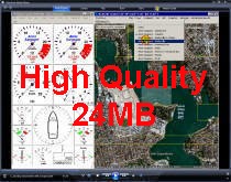
5 minute video clip on these
enhancements:
The Google
Earth interface in build 2006112507 provided the ability
for C_wiz to launch an instance of Google Earth then, on
this instance:
o
Overlay C_wiz charts at a user defined translucence.
o
Display C_wiz vessel voyage tracks with user defined
properties.
o
Use
GE navigation control to vary view properties.
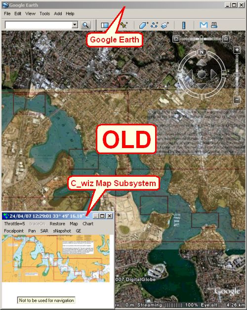
This was
rather primitive, requiring the presence on the screen
of 2 "map windows":
o
C_wiz Map
subsystem so that the user could interact with C_wiz map
data to
control map related functionality.
o
Google
Earth so the user could view the results.
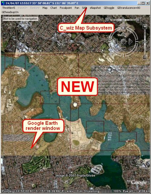
With build
2007112515, Google Earth is seamlessly integrated into
the C_wiz Map subsystem so only 1 "map window" is
required.
At the
click of the C_wiz Map subsystem [GEtoggle] menu the
Google Earth render window is "toggled in" to the C_wiz
Map subsystem or "toggled out" and returned to Google Earth.
When Google
Earth is "toggled in", the user
can interact with the Google Earth representation of the
C_wiz map data inside the C_wiz Map Subsytem in much the same way as
before the Google Earth interface existed.
These
interactions include the ability to control all mouse
actions when the mouse cursor is on the Google Earth
render window, for example:
o
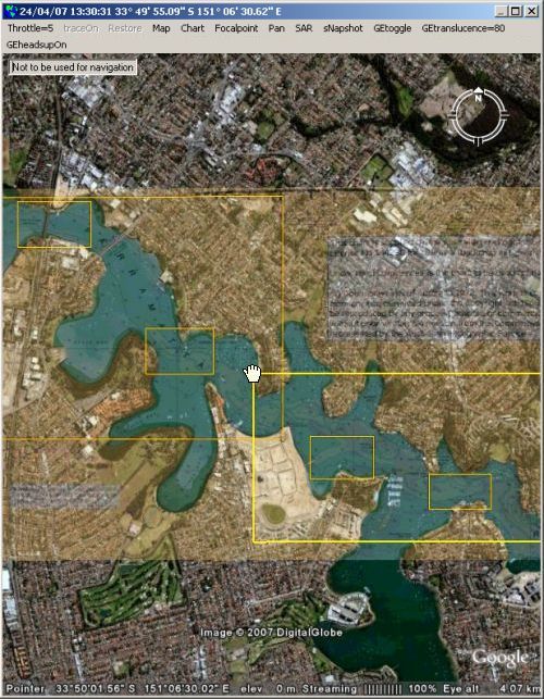
Read
latitude and longitude at the mouse cursor location - a
"so what!" bit of functionality that requires some
inordinately complex coding and is also the basis for
much of the more sophisticated user interactions. Look
closely at the above figure - at the bottom is the
latitude and longitude of the cursor as known to Google
Earth, in the caption at the top is the latitude and
longitude as known to C_wiz.
o
Double left
click to toggle C_wiz chart boxes on (or off).
o
Move the
mouse cursor over a corner of a C_wiz chart box to
highlight the chart box, as per the following figure.
o
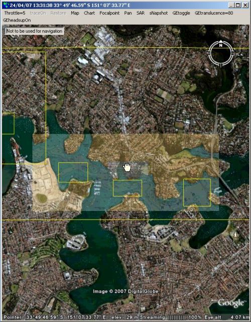
Left click
the corner of a chart box while it is highlit to cause
the relevant chart to be overlaid on Google Earth, as
per the following figure:
o
Toggle
historic vessel track traces on by clicking
the C_wiz Map subsystem [traceOn] menu.
o
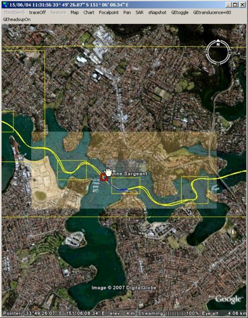
Right click
in the vicinity of a historic vessel track trace and
cause C_wiz to find the vessel and time that
corresponds, as per the following figure:
o
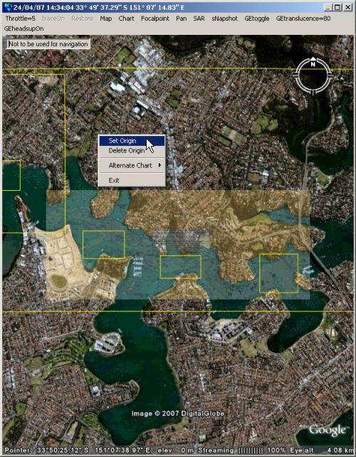
Double
right click to bring up the C_wiz Map subsystem pop-up
menu, as per the following figure:
o
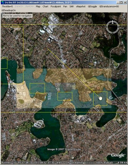
Set an
origin from the pop-up menu which results in a "rubber
band" distance tool similar to the Google Earth Ruler
tool, as per the following figure, noting that the
location information in the caption has changed to
northing /easting /(direct distance /bearing) from the
origin previously established:
o
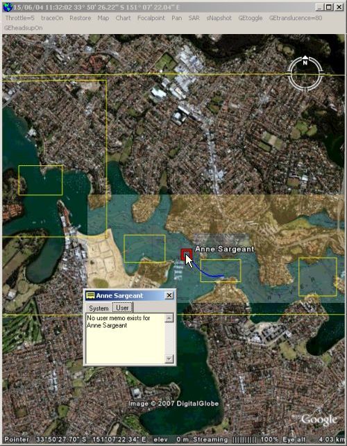
Left click
a C_wiz vessel or fixed focal point to launch the focal
point's memo, as per the following figure:
o
Double left
click a C_wiz vessel focal point to toggle it in or out
of being the "panning vessel". When a "panning vessel"
is defined the C_wiz Map subsystem automatically pans to
keep the vessel in the viewable area.
o
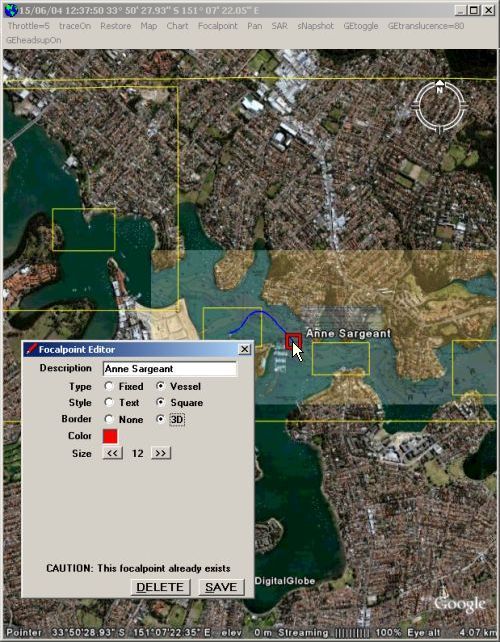
Right click
a C_wiz vessel or fixed focal point to launch the focal
point editor, as per the following figure:
o
Double
right click a C_wiz vessel or fixed focal point to
toggle it in or out of being the origin.
o
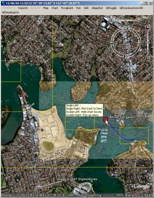
Hit the F1
key to toggle C_wiz Test Drive on (or off) then observe
the mouse tooltip that appears when the mouse cursor
hovers anywhere on the Google Earth render window, as
per the following figure:
As a
by-product, it is also possible to have both the C_wiz
Map subsystem and Google Earth "map windows" on the
screen and interact with the C_wiz map data in either
window with appropriate responses simultaneously
appearing in both windows.
Video Capture
View a
6 minute video clip on these
enhancements:
Some
present and potential customers have indicated a desire
for an integrated video
capture capability. The suggested potential uses for
such a capability have included:
o
Radar sweep
capture - many radars have an analog video out option which can
be used to drive a remote monitor - or a video capture
device.
o
Wheelhouse
monitoring.
o
Engine room monitoring.
o
Passenger
monitoring.
o
Monitoring
of patrol boat boarding operations.
In response
to these requirements a new C_wiz D3 (data device
driver) has been developed which saves video frame grabs
(as *.jpg files) from the video stream/s supplied to video
devices attached to a PC. Frequency, quality and
size of the video frame grabs is user definable.
Location, date and time stamps are automatically
embedded in each video frame grab to provide an audit
trail.
To cover
the maximum possible range of video devices the
Frame Grabber D3 uses the Multimedia SDK (Software
Development Kit) from LEAD Technologies. To quote from
the SDK documentation, this allows the creation of
"applications that can capture from WDM, native
DirectShow including DV, Video for Windows capture
devices, control DV devices, etc", in other words just
about any video device that you could plug into
a modern PC.
The D3 has
been tested with various video devices:
o
Multi-input
frame grabbers - typically a PCI card with several BNC
or RCA connectors that will take composite video signals
from surveillance video cameras, radar etc. These sorts
of devices can typically handle up to 16 composite video
signals. Examples are the Euresys and FALCON lines.
Appropriate to use these devices when more than 2 video
signals are to be handled.
o
USB TV
tuners - typically a small in-line device with a RCA
composite video input and a USB output. Example is the
Belkin Hi-Speed USB DVD Creator. Appropriate to use
these devices when 1 or 2 video signals are to be
handled (any more and you will get USB contention
problems). These are a cheap and effective way to add a
radar sweep capture capability to C_wiz.
o
USB or
Firewire cameras - "webcams". There are any number of
possibilities here. If you attempt to use too many you
will end up with USB or Firewire contention problems.
A companion
Frame Grabber Disk Manager D3 has also been developed
which enables a user to ensure there is always space
available
on the disk drive that contains the video frame grabs
by, if necessary, deleting the oldest in blocks of 1
hour.
C_wiz
itself has been enhanced with a Video subsystem that
allows the user to view in
real-time, play or plot modes appropriate video frame
grabs completely synchronized to all the other data simultaneously captured.
Chinese Walls
C_wiz has
evolved to be a quite complex product containing a
number of quasi independent subsystems.
Up until
now, in an attempt to keep the product as simple as
possible from a user perspective (and also keep the
coding effort down), essentially only one subsystem at a
time was allowed to interact with the user.
So if you
started playing a history script then launched the Map
subsystem you had to close the Map subsystem before you
could stop playing - faintly annoying but not totally
repugnant.
This
"architecture" really started to show its limitations
with the advent of the Video subsystem which would have
required [Video] menus in the main C_wiz window as well
as the Plot and Map subsystems.
So the
"Chinese walls" have been torn down and the user can, in
the main, jump between subsystems at will. This has
required a major investment in time (primarily testing)
but the result is a much more intuitive user experience. |


